

Exam 1º H The three main types of map projections
Sure! Here’s a clear explanation of Earth’s projections:
a) The three main types of map projections are:
- Cylindrical projection
- Conic projection
- Azimuthal (or planar) projection
b) Explanation of each type:
1. Cylindrical Projection
This type wraps a cylinder around the Earth. Imagine placing a piece of paper around a globe like a label on a can, then projecting the Earth’s surface onto it.
- Best for: World maps
- Pros: Keeps straight lines and directions accurate
- Cons: Distorts size, especially near the poles (e.g., Greenland looks way bigger than it really is on the Mercator map)
2. Conic Projection
Think of placing a cone over Earth, touching it at a specific latitude. The map is then «unfolded» into a flat surface.
- Best for: Mapping small areas like countries or continents (especially in mid-latitudes)
- Pros: Less distortion for specific regions
- Cons: Not great for mapping the whole world
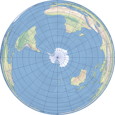
3. Azimuthal (Planar) Projection
This type places a flat sheet directly on one point of Earth (like putting a piece of paper on the top of a globe) and projects the surface outward.
- Best for: Polar areas or air route maps
- Pros: Shows distances and directions accurately from the center point
- Cons: Gets distorted farther from the center
